|
|
|
Two clickable maps are provided here.
| The
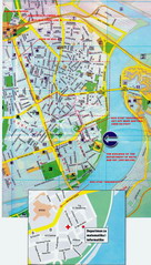
first one is the map of a wider downtown of Novi Sad,
and it includes the city's train and bus stations, the Petrovaradin
fortress and the University campus (pointed at by the navy-blue
arrow). The building of our Department
is particularly highlighted. |
 |
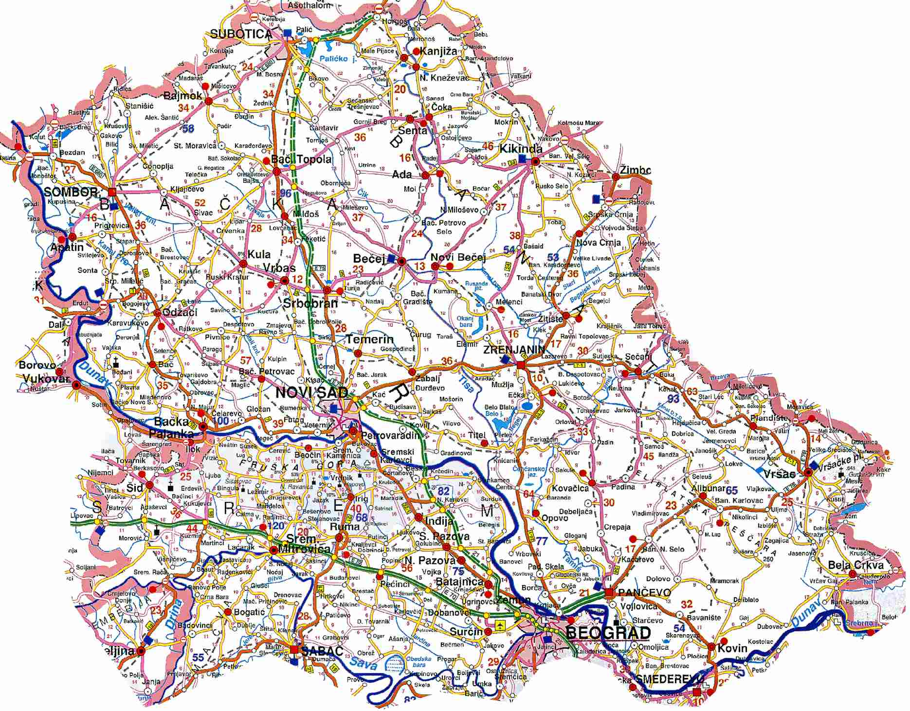
| The second map is that of
Vojvodina
province featuring Serbia's capital, Belgrade, the most important roads,
Serbia's borders with Croatia, Hungary and Romania (and a little
part of that with Bosnia-Herzegovina). The large freeways are
highlighted in green: the one running north-south is a part of the
Salzburg-Vienna-Budapest-Novi Sad-Belgrade-Niš-Sofia-Istanbul Pan-European
Corridor X (branches Xb+Xc), while the other (running west-east)
is a part of the Ljubljana-Zagreb-Belgrade highway.
|
 |
|